Swiss long-haul travel specialist for over 50 years
Darwin

Holidays in Darwin
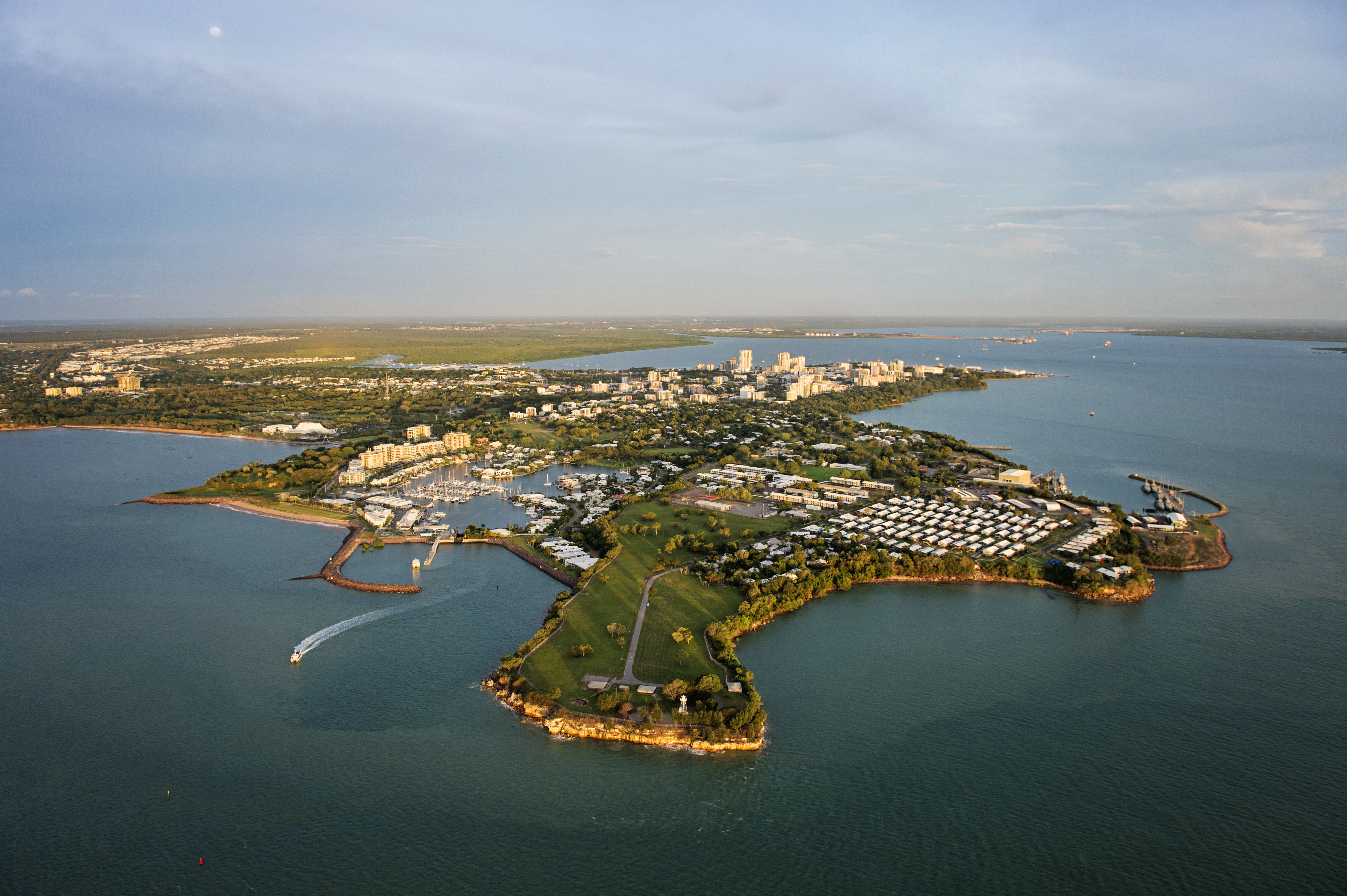
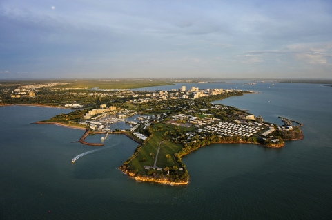
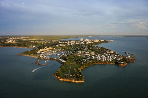
Darwin is Australia’s northernmost city and, thanks to its location, also a gateway for journeys to Southeast Asia. Its multicultural flair and constant tropical warmth give Darwin a special character and make it an ideal holiday destination. Yet for all its sights, the region’s true beauty lies beyond the city, and there is a wide choice of excursions into the surrounding national parks. Don’t miss the famous Mindil Beach Sunset Market (every Thursday and Sunday during the dry season). Savour the many delicacies on offer before settling down on the beach to watch the sunset. In the local museums you can admire Aboriginal art and learn more about Darwin’s at times tragic history.
From Perth to Darwin – a land of contrasts
Living fossils and mountains like beehives, red outback and blue coastlines, colourful reefs and thundering waterfalls: the route from Perth to Darwin is lined with extraordinary scenery. Once you have enjoyed Perth’s relaxed city life and its well-kept beaches, take the Great Eastern Highway through the suburbs to Midland. Here, in the Swan River valley, the Great Northern Highway begins.
The route sets off gently, with the softly rolling hills of the Darling Ranges and quiet farming villages. After Moore River National Park, with its untouched heathland and flowering banksia shrubs, we turn off towards the coast at the Windmill Roadhouse and follow Indian Ocean Drive to Nambung National Park. Here, weathered limestone pillars rise up to four metres from the yellowish-grey quartz sand of ancient dunes, where endemic dryandra species with clusters of yellow and white flowers and dark foliage add touches of colour to the yellow desert. Experience the Pinnacles in the light of the rising or setting sun! An unsealed loop road runs through the park, and you can easily manage it in a motorhome or hire car even without four-wheel drive – the sandy track is rock hard. The vehicle loop is complemented by a 1.5 km walking trail: the Desert View Trail starts at the car park. Afterwards, the ‘Lobster Shack’ in Cervantes tempts you with fresh lobster for lunch, and on the ‘Lobster Pot Pulling’ tour you can see up close how they are caught! Past seaside towns such as Leeman, Indian Ocean Drive takes us back onto Highway 1 at Dongara, and we soon reach the sun city of Geraldton – even in winter, in July, it is at least 20 degrees here thanks to the many hours of sunshine! North of Northampton we come across the Dingo Fence. Several thousand kilometres long, it is meant to protect the farmland of the south from wild dogs and rabbits.
It meets this aim with only moderate success, but the fence is still maintained and monitored. The vast bush grows ever lonelier. There are no more villages on the highway until Carnarvon, just three roadhouses – Billabong (Aboriginal for ‘waterhole’), Overlander and Wooramel. Always fill up as soon as the fuel gauge reaches half! And over a flat white or a cup of tea, soak up the unique atmosphere of these supply stops in the middle of nowhere.
If you would like to visit Kalbarri, with its national park and rugged rocky coastline, you can now leave the highway as early as Northampton – a well-built loop road complements the existing access road. It opens up fantastic rock formations that you can admire from lookouts, as well as two new skywalks: since March 2018 they have jutted 20 metres out over the gorge – 100 metres above the Murchison River! In the Australian spring, a magnificent carpet of wildflowers covers the national park. Another popular photo subject is the Nature’s Window rock arch, reached by an easy 800-metre walking trail. The road to the UNESCO World Heritage Site of Shark Bay begins at the Overlander Roadhouse. Along the 26th parallel, it first leads to Hamelin Pool, with its old telegraph station and some very special life forms: the stromatolites – tiny blue-green cyanobacteria that, 3.5 billion years ago, produced biomass in the primordial soup of the oceans from which all life evolved. Shell Beach consists of a layer of billions of snow-white shells up to ten metres deep. From the cliffs of Eagle Bluff we watch manta rays dancing in the sea. At Monkey Mia, dolphins have been coming into the shallow water by the beach for over 50 years; rangers introduce them to visitors, feed them a handful of fish and study their behaviour. Only in a four-wheel-drive vehicle can you explore François Peron National Park, with its fishing spots and hidden beaches at the very northern tip of Shark Bay. Oyster lovers can gather them from the rock shelves of the Indian Ocean and enjoy them right on the beach, fresh or grilled. With a little luck, snorkellers may even encounter a real sea cow: Shark Bay is also home to the world’s largest dugong population.
Shark Bay marks a climatic boundary. In the plantations of Carnarvon, bananas and melons take the place of apples. They are irrigated by the Gascoyne River, which flows on only 120 days a year. Cattle and sheep were once the mainstay of the region’s farming. As early as 1880, Carnarvon was given a 1.8 km jetty for loading them – a first in the state at the time. Today the nostalgic ‘Coffee Pot’ narrow-gauge railway trundles out to the end of the jetty, where anglers pull delicious yellowfin bream from the water.
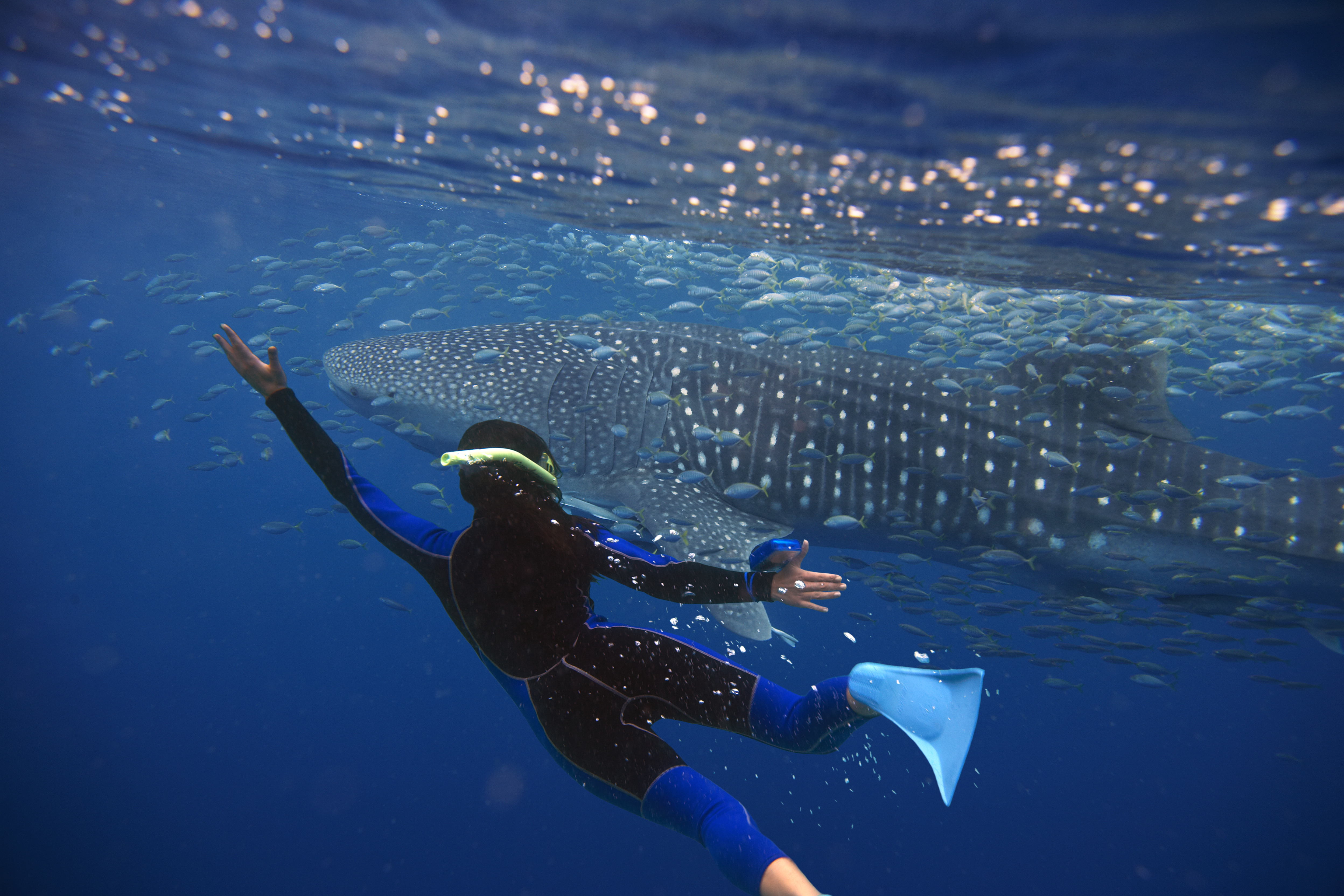
North of Carnarvon comes the Minilya Roadhouse, an exotic rest stop teeming with wildlife near the Tropic of Capricorn. Now things turn tropical and utterly idyllic, as the detour to Coral Bay proves: dazzling white on the beach, turquoise blue in the sea. Your voyage of discovery into the underwater world of the nearby coral reefs begins right on the beach. Take a wildlife-watching trip in a glass-bottom boat! The true giants are the fish that make their way to Ningaloo Reef, a UNESCO World Heritage Site: from March to July you can observe whale sharks. This grey giant with white spots grows up to 18 metres long – three times the length of a great white shark – and is completely harmless. It feeds exclusively on zooplankton – fish larvae, small fish and squid – which it takes in through a mouth lined with more than a thousand teeth. Experience the world’s largest fish while diving or snorkelling! From June to November, humpback whales turn Ningaloo Marine Park into a ‘Humpback Highway’; 529 species of fish and 250 species of coral create a unique play of colour all year round on Australia’s largest fringing reef.
Its coral gardens often lie just 20 metres from the white sandy beaches of the coast. Cape Range National Park runs alongside the coast with its rugged sandstone cliffs, deep canyons and 50 kilometres of unspoilt beach, where the luxurious Sal Salis safari camp hides among the dunes. On a quad bike, your nimble four-wheeled companion, you can reach hidden corners of the coral coast that are hard to get to on foot, such as Yardie Creek, and carry on to the Exmouth Peninsula with its beaches and limestone hills.
But why always stick to Highway 1 along the coast? Inland, too, there are natural wonders such as the spectacular Karijini National Park, which reveals the Earth’s primeval past: four-billion-year-old rock glowing red, and huge gorges where waterfalls plunge into pools up to 100 m deep, filled with ice-cold, crystal-clear water. Termite mounds rise from expanses of yellow-green spinifex grass, and here and there a majestic eucalyptus towers above the low scrub. Walking trails of various lengths lead to lookouts and the most beautiful spots in the park. The iron ore mined here is carried on freight trains hundreds of metres long to Port Hedland, the hub for the ores of the Pilbara region and a centre of salt production. Huge white salt cones frame the town, which has boomed since the 1960s thanks to mining. Further north lies 80 Miles Beach, the endless shore where the Great Sandy Desert meets the Indian Ocean. From May to October, on full-moon nights, you can marvel at a unique natural spectacle on the coast: the ‘Staircase to the Moon’. The staircase is actually an optical illusion. As the water recedes at low tide, the rising moon is reflected in the small pools left behind on the beach – creating the impression of a staircase rising from the horizon. Between Port Hedland and Broome, the event is celebrated with colourful craft markets, local musicians and talented street performers.
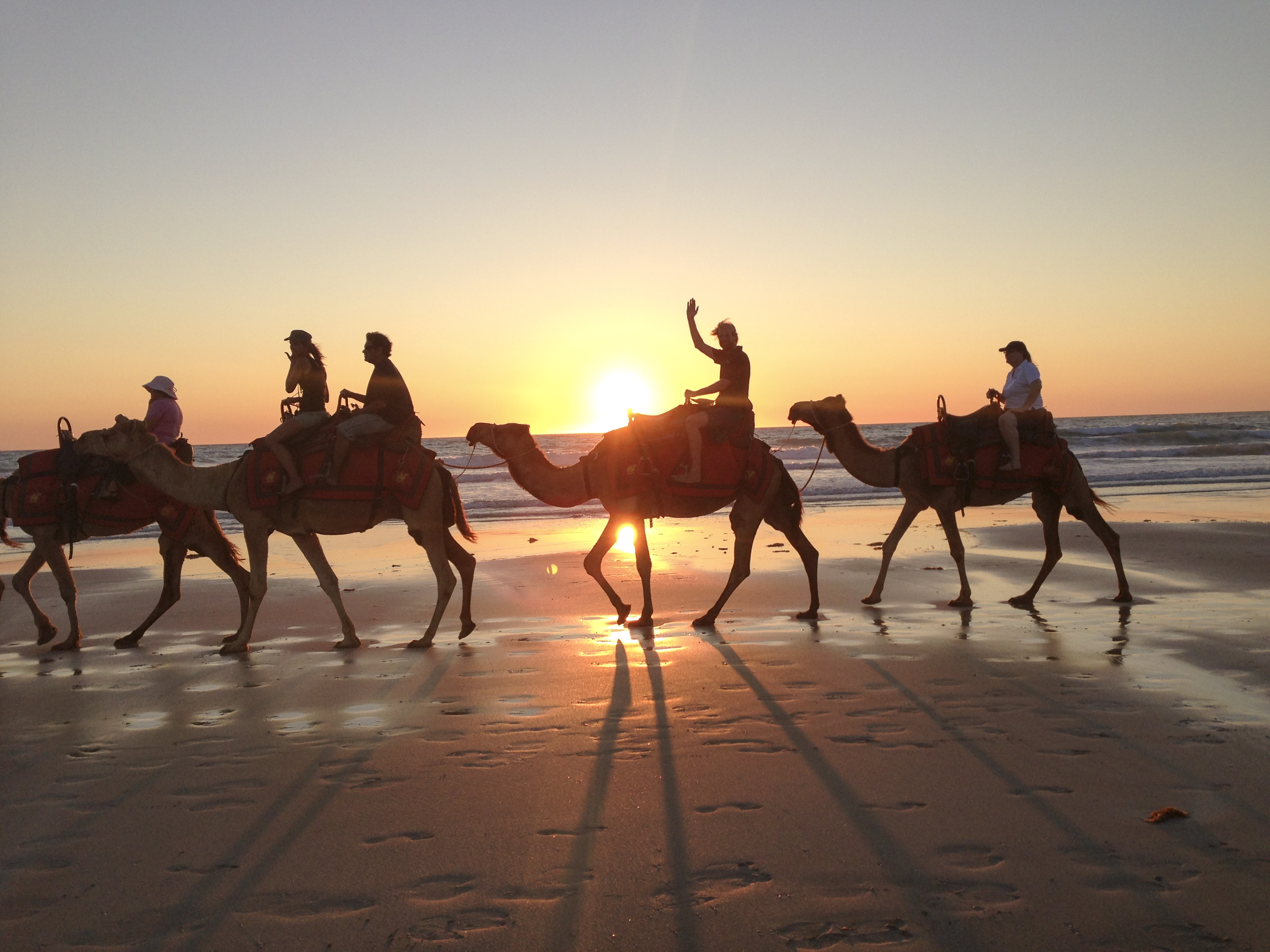
As soon as the first rays of sunshine chase away the sparkling stars of the tropical sky, the kookaburras greet the day. There must be thousands of them hiding in the trees of Broome. Against the fiery red sky glowing above the low bungalows, a camel train pauses on Cable Beach. At sunrise and sunset, this 22 km dream beach on the Indian Ocean is a cult spot in Western Australia’s tropical capital. The famous beach owes its name to the first overseas telegraph cable, which was laid into the sea here. It was once pearl divers from China who shaped Broome and founded a small Chinatown – today the town’s nightlife and shopping district. The pearl industry also drew the Japanese, who found their final resting place in the Japanese cemetery dating from 1896. Its 707 headstones were made from beach rock in many different colours. At the pearl museum you can find out how South Sea pearls are cultivated. A sunset cruise across Roebuck Bay on an old pearl lugger is truly romantic. For some, Broome means la dolce vita in the tropics. Others set off from here to cross the fifth continent on the Savannah Way. Here, the sweet notes of frangipani give way to the spicy scent of saltbush and mallee. Like a broad ribbon of asphalt, the road runs dead straight through the bush. Kangaroos doze by the roadside as a road train thunders past. Once under way, these megatrucks – up to 53 m long, with 800 hp, 18 axles, 70 wheels and 93,000 litres of fuel – are reluctant to stop, and animals hopping onto the road are mercilessly struck by the huge bull bars. More and more curious trees appear in the bush: boabs – in Derby, one of these bottle trees grew so large that its trunk was hollowed out and used as a prison!
Off-road fans can now look forward to the legendary Gibb River Road: the historic ‘Beef Road’, which once linked the great cattle stations of the Kimberley, is sealed only for the first 74 kilometres. After that, this alternative to the highway is a genuine corrugated track, sometimes stony, sometimes sandy – and closed during the wet season from November to April. Seven gorges line the legendary route. Particularly impressive is Windjana Gorge, carved by the Lennard River into the Napier Range. Its rock walls tower almost 100 m high, stained black by fungi and dark red by iron oxide. You get a real stockman feeling on the big cattle stations such as Mount Elizabeth on the Gibb River Road. At Bullo Station, the largest cattle station in the Northern Territory, you experience the everyday life of Australian cowboys first-hand – and rather than simply watching them on a jeep ride together, you lend a hand yourself.
Only by four-wheel drive can you reach a World Heritage Site that a film crew stumbled upon by chance in 1983: the Bungle Bungle Range. The local Kija Aboriginal people had known the sandstone domes for more than 20.000 years. Today they are part of Purnululu National Park, a fascinating paradise for wilderness hikes. From the Piccanniny car park, trails lead to Cathedral Gorge, a huge cavern with a waterhole, and to a lookout with 360-degree views over untouched nature.
Later, we follow a dry creek bed into the ever-narrowing Echidna Chasm, where primeval Livistona palms rise delicately against the deep-red sandstone walls until barely a ray of sunlight reaches the ground. Not only in the Bungle Bungles but also later in Kununurra, we take the opportunity for a scenic flight. The vastness of the national parks is best appreciated from the air, with the rock domes stretching to the horizon. Four times the size of Lake Constance, Lake Argyle glitters below us. On its southern shore, a mine extracts coveted gems found only here: pink diamonds.
Wyndham is home to the big crocs. Huge salties – saltwater crocodiles up to eight metres long – lurk in the water: the Crocodile Lookout at the old abattoir wharf is the ideal place to watch them! The Great Northern Highway ends in Wyndham. The Savannah Way now follows the Victoria Highway to Katherine in the Northern Territory (NT), skirting two national parks that are – still – considered insider tips: Keep River National Park with its ancient Aboriginal rock paintings, and the vast off-road paradise of Judbarra (Gregory National Park) with its imposing boab trees. In Timber Creek, the locals cast their fishing lines into the Victoria River, hoping a barramundi will bite. This delicious giant perch is also the favourite food of the crocodiles lurking beneath the surface of the murky current, and signs all along the banks warn of the reptiles. Less dangerous than the ‘salties’ are the small, shy ‘freshies’, which lay their eggs on the banks of the Katherine River. Over 650 million years, the river has carved its way through the rock, creating 13 gorges with sandstone cliffs 100 m high – the fifth ends at an idyllic sandy beach. Paddlers in life jackets and Akubra hats drift on the water. In the wet season, the canoes give way to motorboats that reveal the beauty of the gorge.
In Nitmiluk National Park (Katherine Gorge), pandanus palms line the natural pools of Leliyn (Edith) Falls, into which thundering waterfalls plunge. The land grows ever more tropical and green. At Pine Creek we leave the highway one last time and follow the old routes of the first settlers to Litchfield National Park, where waterfalls and natural pools such as Florence and Wangi Falls or Buley Rockhole invite you to swim amid lush monsoon forest. The Table Top Track links the park’s most beautiful waterfalls on a four-day bushwalk across the Table Top sandstone plateau. The magnetic termite mounds of the Lost City rise up to six metres high and are aligned exactly north–south – this is how the termites regulate the temperature inside.
Our customers’ favourite Darwin trips
FREE BROCHURE ORDER
 The travel agencies of the knecht reisen group